


Lincoln County Precinct 1, Lincoln County, New Mexico
About
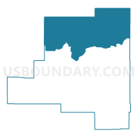
Outline

Summary
| Unique Area Identifier | 623659 |
| Name | Lincoln County Precinct 1 |
| County | Lincoln County |
| State | New Mexico |
| Area (square miles) | 1,402.11 |
| Land Area (square miles) | 1,402.11 |
| Water Area (square miles) | 0.00 |
| % of Land Area | 100.00 |
| % of Water Area | 0.00 |
| Latitude of the Internal Point | 34.11348440 |
| Longtitude of the Internal Point | -105.38456610 |
Maps


Graphs
Select a template below for downloading or customizing gragh for Lincoln County Precinct 1, Lincoln County, New Mexico


Neighbors
Neighoring Voting District (by Name) Neighboring Voting District on the Map
- Chaves County Precinct 10, Chaves County, NM
- De Baca County Precinct 1, De Baca County, NM
- Guadalupe County Precinct 4, Guadalupe County, NM
- Lincoln County Precinct 18, Lincoln County, NM
- Lincoln County Precinct 19, Lincoln County, NM
- Lincoln County Precinct 3, Lincoln County, NM
- Socorro County Precinct 12, Socorro County, NM
- Torrance County Precinct 12, Torrance County, NM
- Torrance County Precinct 8, Torrance County, NM
Top 10 Neighboring County Subdivision (by Population) Neighboring County Subdivision on the Map
- Northwest Chaves CCD, Chaves County, NM (3,125)
- Capitan CCD, Lincoln County, NM (3,052)
- Mountainair-Encino CCD, Torrance County, NM (2,294)
- Carrizozo CCD, Lincoln County, NM (1,423)
- Vaughn CCD, Guadalupe County, NM (524)
- Corona CCD, Lincoln County, NM (403)
- West De Baca CCD, De Baca County, NM (263)
- Claunch CCD, Socorro County, NM (97)
Top 10 Neighboring Place (by Population) Neighboring Place on the Map
Top 10 Neighboring Unified School District (by Population) Neighboring Unified School District on the Map
- Roswell Independent Schools, NM (58,520)
- Estancia Municipal Schools, NM (4,797)
- Capitan Municipal Schools, NM (4,230)
- Fort Sumner Municipal Schools, NM (2,022)
- Carrizozo Municipal Schools, NM (1,534)
- Vaughn Municipal Schools, NM (685)
- Corona Municipal Schools, NM (452)
Top 10 Neighboring State Legislative District Lower Chamber (by Population) Neighboring State Legislative District Lower Chamber on the Map
- State House District 50, NM (31,808)
- State House District 49, NM (31,024)
- State House District 57, NM (26,051)
- State House District 63, NM (24,938)
- State House District 70, NM (23,913)
Top 10 Neighboring State Legislative District Upper Chamber (by Population) Neighboring State Legislative District Upper Chamber on the Map
- State Senate District 30, NM (48,188)
- State Senate District 33, NM (45,419)
- State Senate District 27, NM (44,424)
- State Senate District 8, NM (40,059)
Top 10 Neighboring 111th Congressional District (by Population) Neighboring 111th Congressional District on the Map
Top 10 Neighboring Census Tract (by Population) Neighboring Census Tract on the Map
- Census Tract 9616, Guadalupe County, NM (4,687)
- Census Tract 9781, Socorro County, NM (4,253)
- Census Tract 11.02, Chaves County, NM (3,927)
- Census Tract 9603, Lincoln County, NM (3,052)
- Census Tract 9637, Torrance County, NM (2,294)
- Census Tract 9601, De Baca County, NM (2,022)
- Census Tract 9602, Lincoln County, NM (1,826)
Top 10 Neighboring 5-Digit ZIP Code Tabulation Area (by Population) Neighboring 5-Digit ZIP Code Tabulation Area on the Map
- 88201, NM (25,490)
- 88316, NM (2,351)
- 88119, NM (1,932)
- 87036, NM (1,868)
- 88301, NM (1,386)
- 88353, NM (473)
- 88318, NM (381)
- 87011, NM (84)
- 88136, NM (44)